On a very hot Sunday at the end of May, I was craving one thing above all: a hike near the water. Preferably one combined with a boat ride and a swim, because honestly, few things feel more Swiss summer than hiking, mountains and hopping on a ship afterwards. Bonus point of choosing a lakeside trail? You can jump into the water whenever the heat becomes a little too ambitious, so don’t forget to bring your swimsuit.
The route I chose is part of the Weg der Schweiz, the Swiss Path Hike, a long-distance trail created in 1991 for Switzerland’s 700th anniversary.
It is perfect for anyone looking for a mostly flat lakeside walk surrounded by dramatic mountain scenery, with the option of a swim and a boat ride thrown into the mix. The full route is around 10 km, but it can also be shortened if needed. Ideal for nature lovers, curious travellers wanting to experience the region where Switzerland has its origins, or anyone searching for a beautiful and easy day trip from Zurich that doesn’t require half a day of travel.
In this guide, I’m sharing everything you need to plan the hike: route details, swimming spots, boat ride options, how to get there from Zurich, where to eat along the way, costs and a few practical tips.
The Swiss Path Hike (Weg der Schweiz) at a Glance
The route I followed between Flüelen and Bauen forms part of one of Switzerland’s most meaningful long-distance trails: the Swiss Path, or Weg der Schweiz.
The trail was created in 1991 to celebrate the 700th anniversary of the Swiss Confederation. More than just a scenic hiking route, it was designed as a tribute to Switzerland’s history and origins. Along the way, hikers pass some of the country’s most important historic sites, including the famous Rütli Meadow, where according to legend the founding oath of the Confederation was sworn, and the iconic Tell Chapel, dedicated to our legendary folk hero, William Tell.
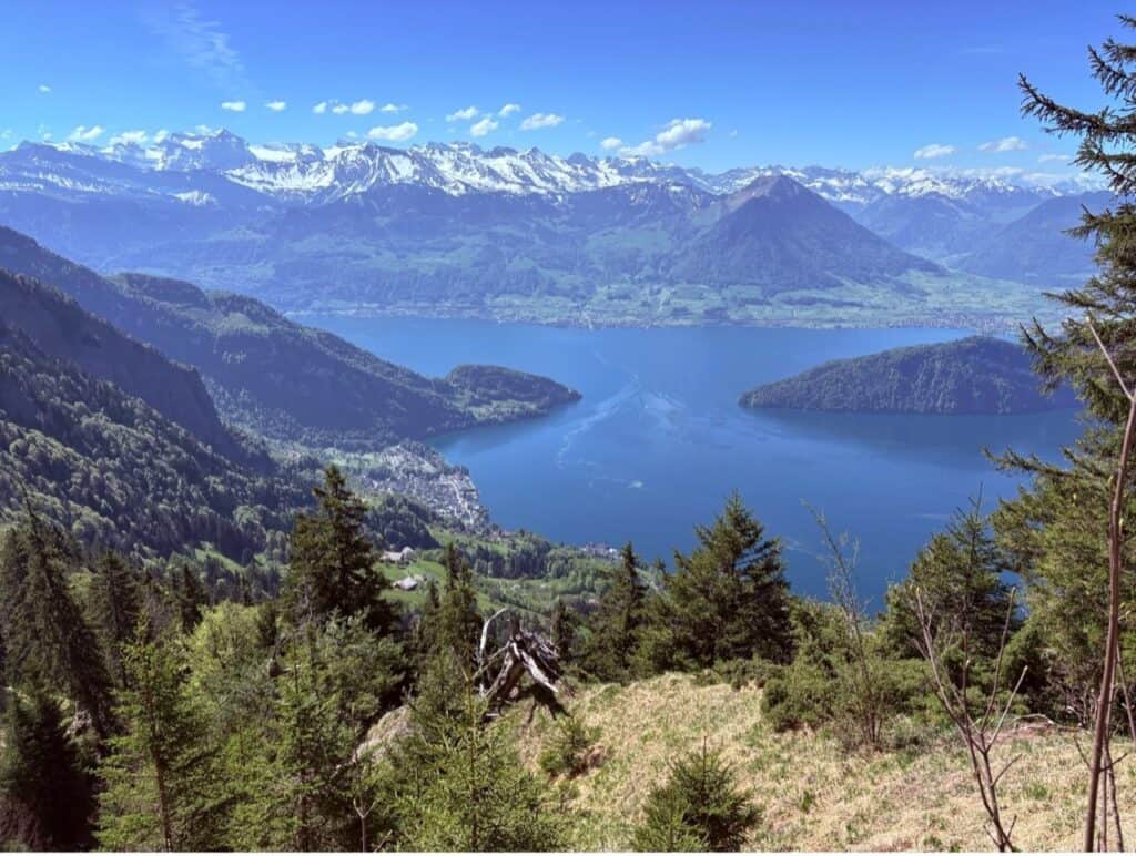
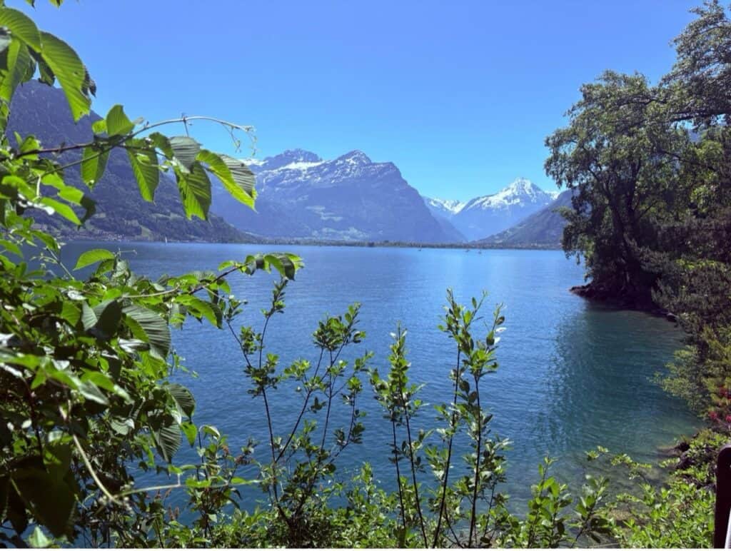
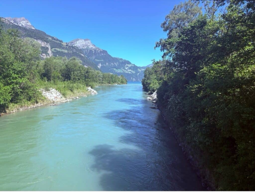
The entire route is approximately 35 kilometers long and circles the southernmost arm of Lake Lucerne. Although ambitious hikers could complete it in a couple of long days, it is traditionally divided into four manageable stages, making it perfect for either a multi-day adventure or individual day hikes.
The trails are generally well maintained and easy to follow, with plenty of opportunities to stop for a swim, enjoy a lakeside picnic or simply sit on a bench and admire the mountain scenery. In my opinion, it’s a hike that perfectly captures what makes walking in Switzerland so special: breathtaking landscapes, excellent infrastructure and a deep connection to the country’s culture and history.
The four official stages of the Swiss Path are:
- Stage 1: Seelisberg to Bauen (9 km)
- Stage 2: Bauen to Flüelen (10 km)
- Stage 3: Flüelen to Sisikon (7 km)
- Stage 4: Sisikon to Brunnen (8 km)
Stage 2 of Swiss Path Between Flüelen to Bauen
I started my day trip from Zurich by hopping on the train to Flüelen and set off on the accessible Route 603, the “Urner Seeuferweg”, directly from the station.
I initially wanted to start my hike in Bauen and walk back to Flüelen, but since I missed the boat to Bauen, I decided to start this segment of the Swiss path the other way around.
From Flüelen to the Lorelei Islands
Today I chose to hike Stage 2 of the Swiss Path, the section between Bauen and Flüelen. Well… that was the original plan anyway.
I had just missed the boat to Bauen, and instead of hanging around waiting for the next one, I figured, “Why not just walk it the other way?” So that’s exactly what I did, hiking from Flüelen to Bauen instead.
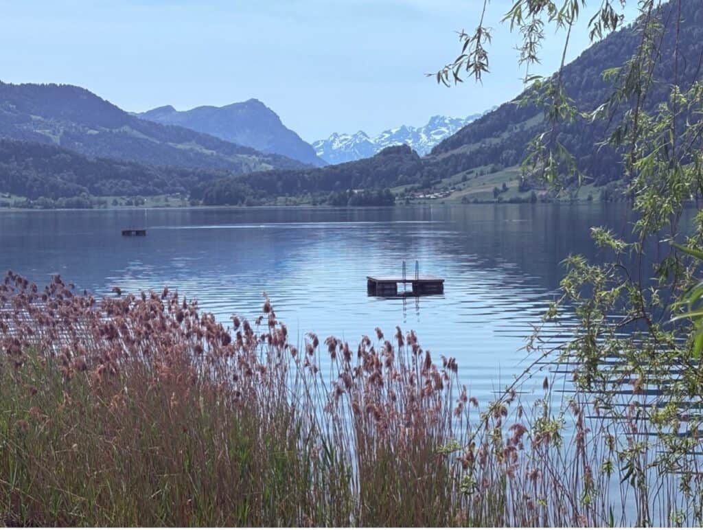
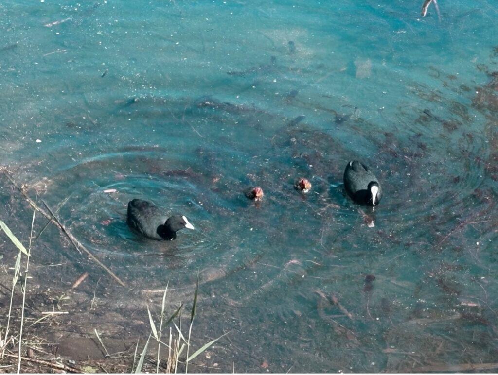
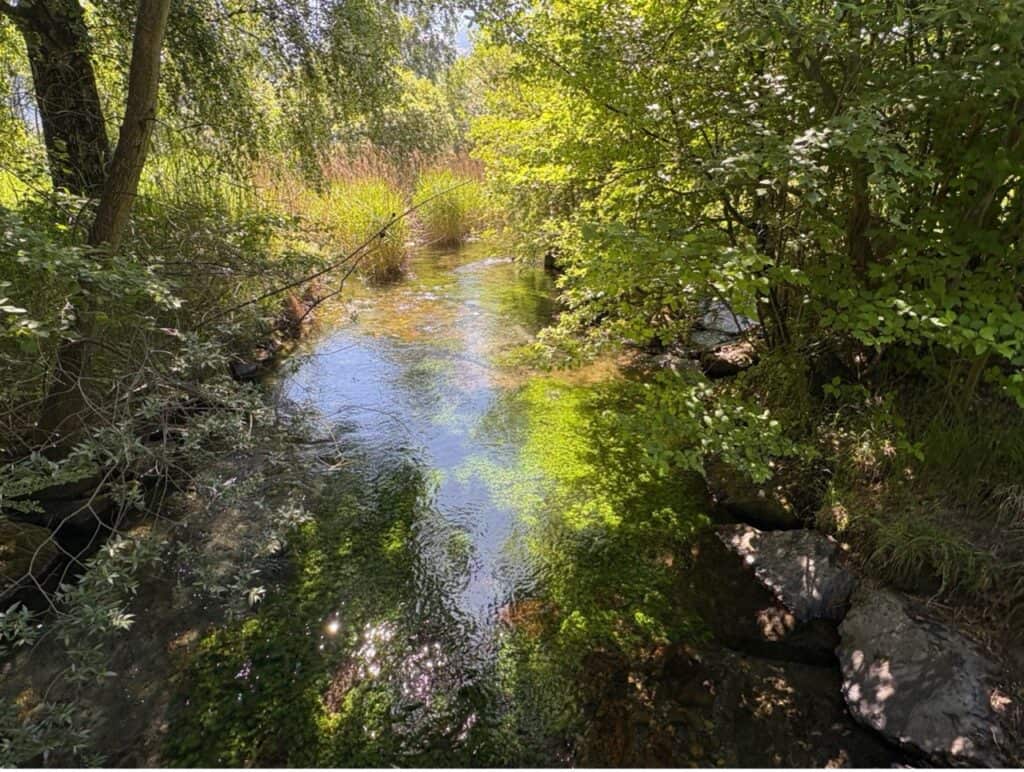
The trail starts by winding through the Reuss Delta, one of Switzerland’s most valuable wetland landscapes. It’s a paradise for birds and home to an incredible variety of plants. I was there at the end of May, and honestly, it felt like nature had turned the volume all the way up. Everything was lush, green, blooming, chirping, buzzing… basically bursting with life.
One of my favorite parts of this first section? The ducklings. I lost count of how many little duck families I spotted along the way. The tiny ducklings paddling behind their mothers were simply adorable and impossible not to stop and watch.

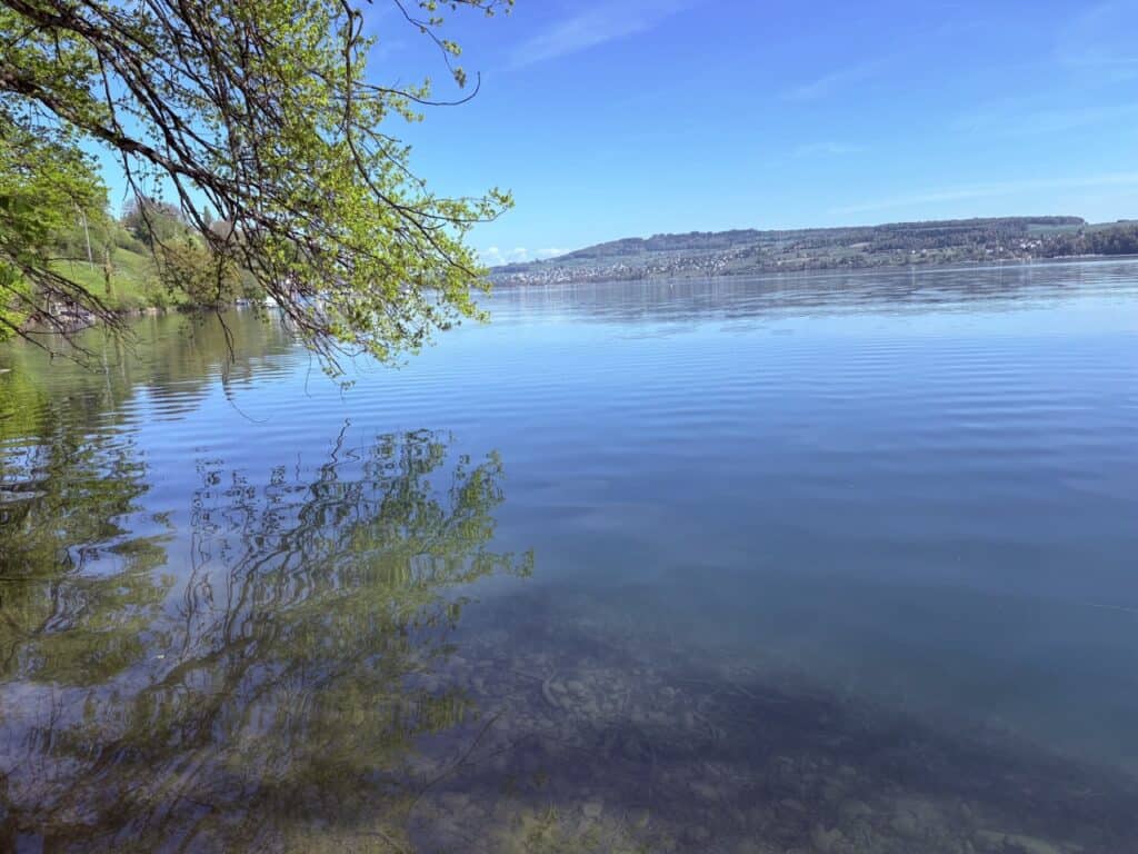
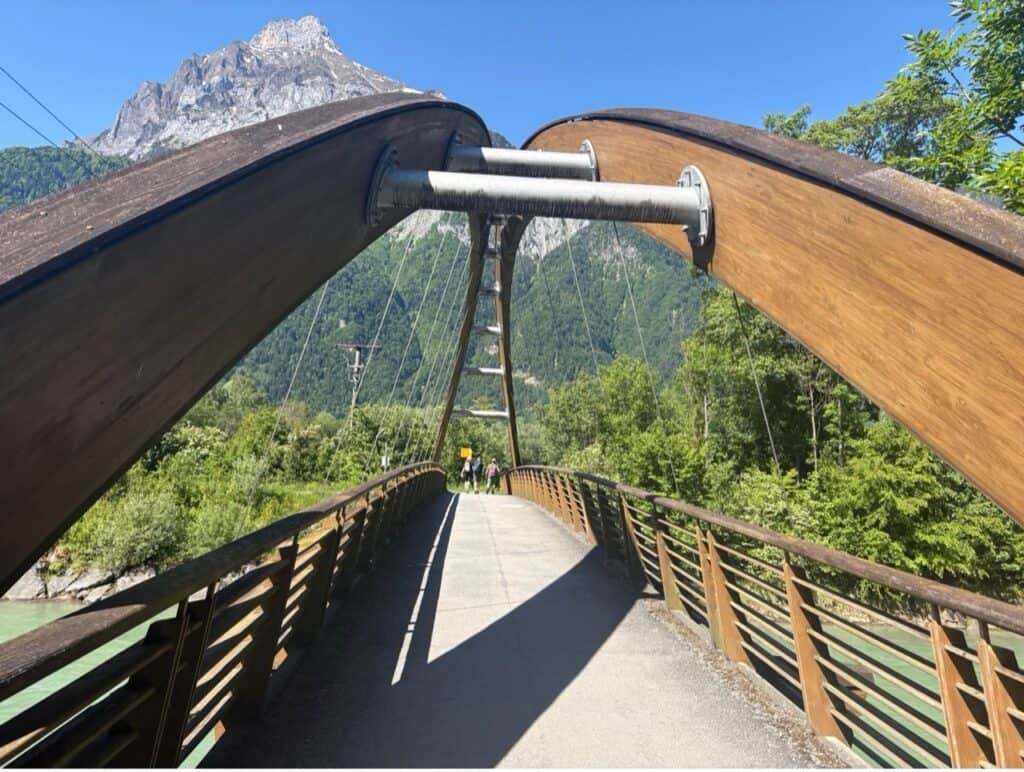
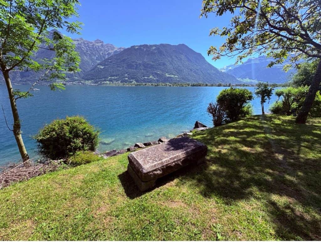
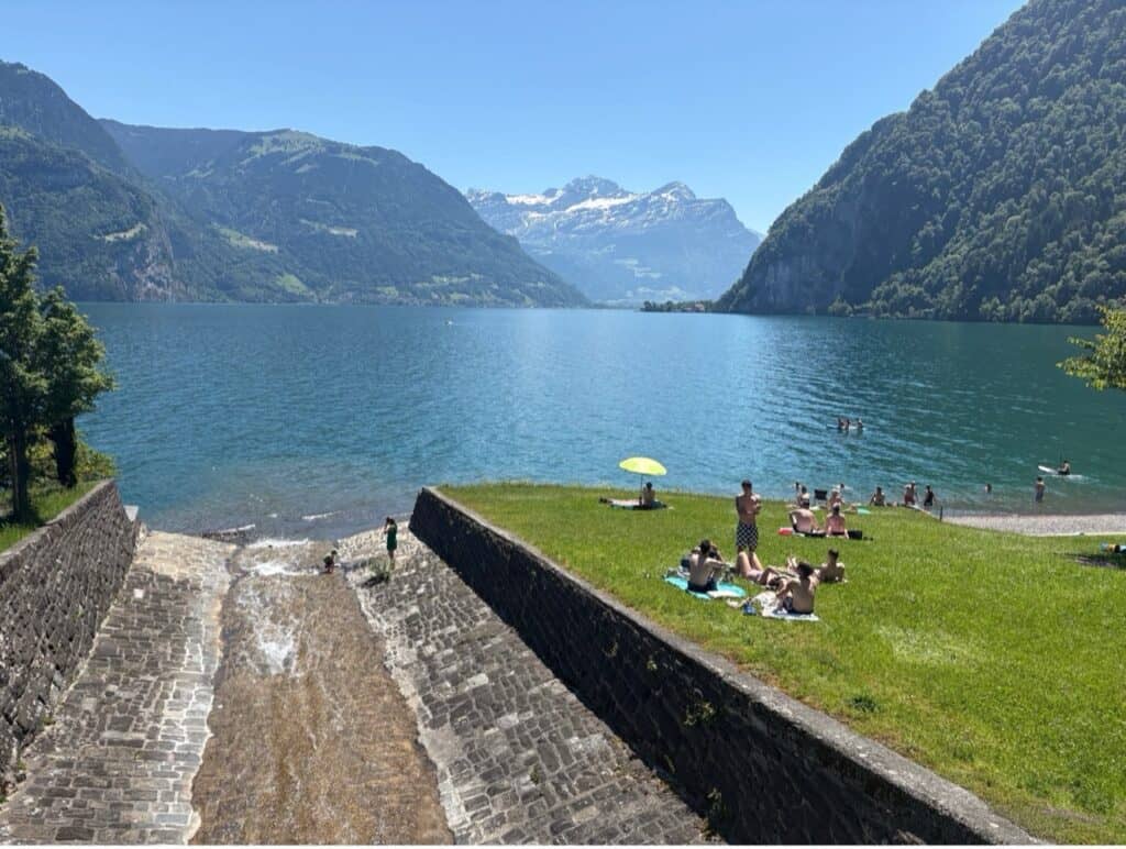
The trail itself is beautiful, winding through a landscape of small canals, streams and gravel banks before crossing a suspension bridge over the River Reuss. Along the route you’ll also pass numerous inviting swimming spots, making it hard not to stop every few minutes.
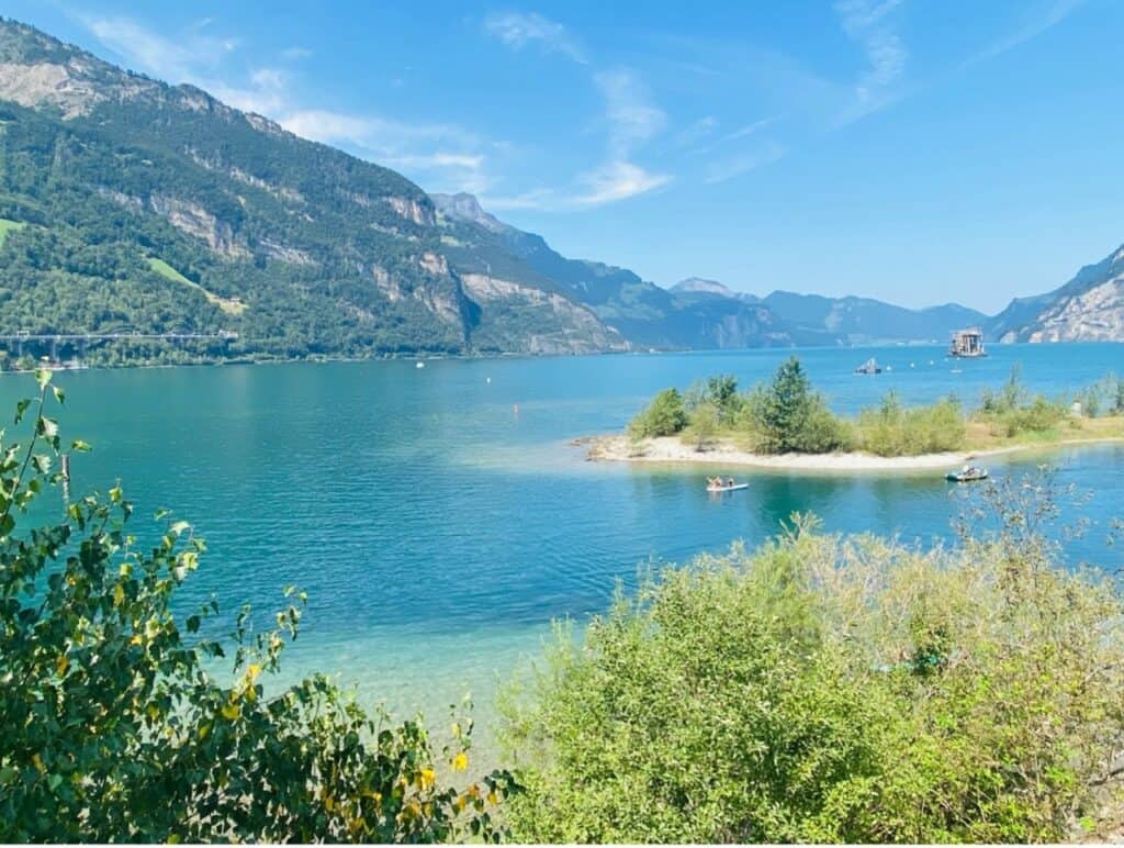
About 30 minutes after leaving Flüelen station, I reached one of the area’s most unusual attractions: the three Lorelei bathing islands.
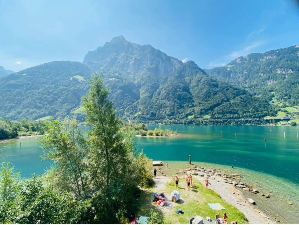
They might look like natural little islands, but they actually have a pretty incredible backstory. They were created from 3.3 million tonnes of rock excavated during the construction of the Gotthard Base Tunnel. I love when places manage to turn something so industrial into something so beautiful.
The islands can only be reached by swimming. From the shore it’s roughly 40 meters across the water. Entry is free, and there is no lifeguard supervision. Around the islands you’ll find barbecue areas, playgrounds, outdoor showers and toilet facilities, making it a fantastic summer destination for families and outdoor enthusiasts alike.
Naturally, I couldn’t resist. A refreshing swim in the crystal-clear lake was exactly what I needed and the perfect excuse to take a longer break before continuing my hike.
Through the Nature Reserve to Seedorf
After drying off in the sunshine, I headed back onto the trail through the protected Reuss Delta nature reserve.
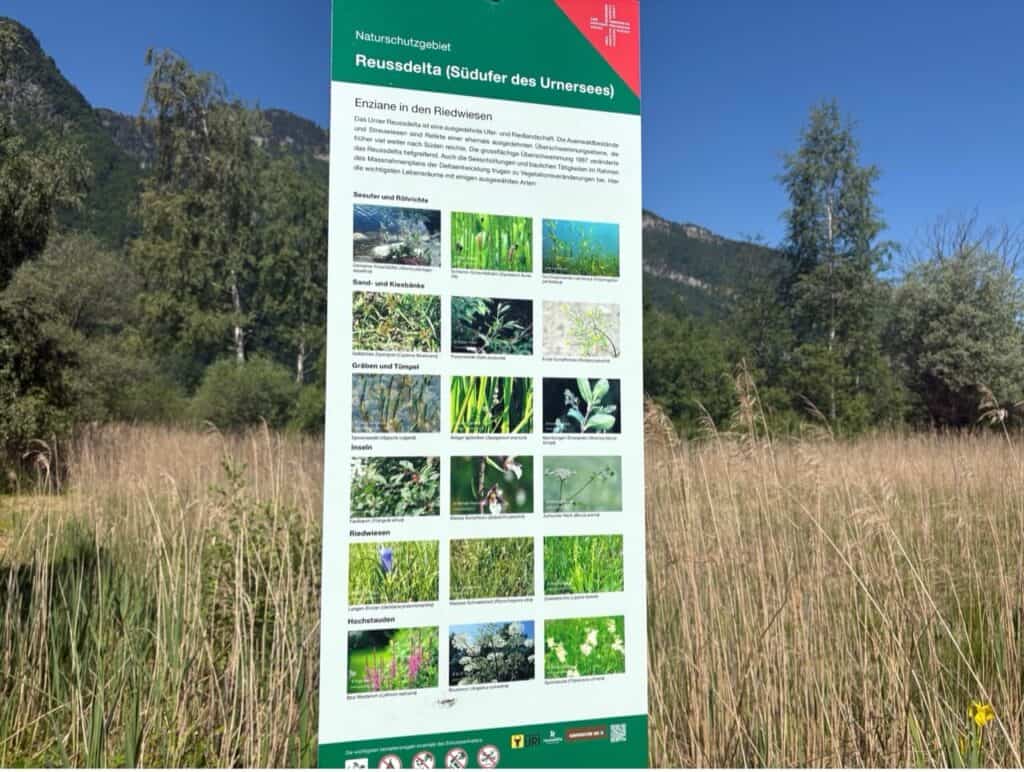
This wild landscape of wetlands, reed meadows, shallow marshes and small islands, all framed by the dramatic mountain scenery of Central Switzerland, is a paradise for nature lovers like me. I could easily have spent hours here birdwatching and simply soaking up the peaceful atmosphere.
Following the lakeside path towards Isleten, I eventually reached the lakeside restaurant (Seerestaurant) in Seedorf, about 15 minutes beyond the Lorelei Islands.
With its self-service restaurant and large sun terrace, it makes a perfect stop for hikers and day-trippers. I stopped for a coffee and enjoyed the magnificent views across the Reuss Delta and Lake Lucerne.
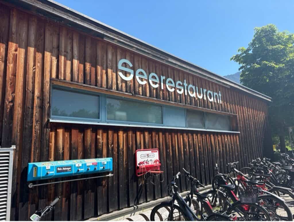
Families will appreciate the large playground right next door, while changing rooms and sanitary facilities make it easy to combine a meal or coffee break with another swim in the lake.
Following the Shoreline to Isleten
After my coffee and swim break, I continued towards Isleten.
This section is a bit of a mixed bag. Some parts follow the main road on hard surfaces, but there are also plenty of beautiful stretches directly along the lakeshore.
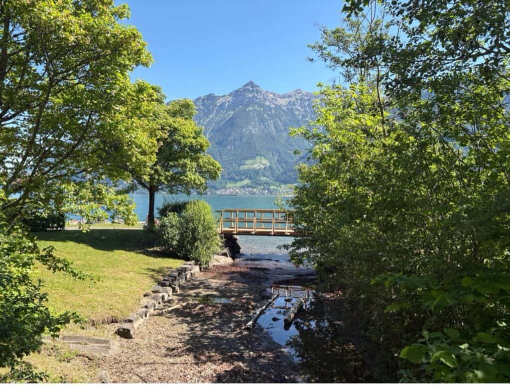
Every now and then you’ll come across another quiet swimming spot or a perfectly placed bench inviting you to sit down and admire the view.
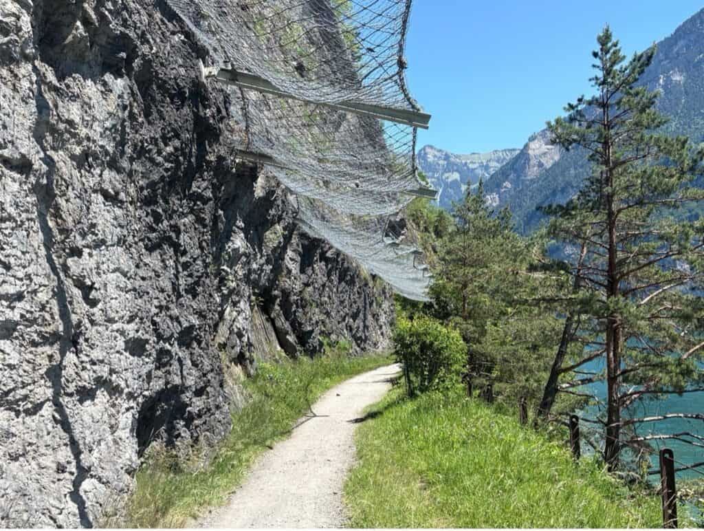
One stretch of the trail passes right below a towering rock face. Huge steel nets are draped over the cliff to catch any falling rocks. It’s a little reminder that, as peaceful as this landscape feels, the mountains are still very much in charge.
Isleten itself is just a tiny hamlet with a handful of houses, but in summer it really comes alive. Thanks to its easy access to the lake and reliable winds, it’s a popular spot for water sports. And if you’re hiking on a warm day, it’s yet another place that’s almost impossible to walk past without jumping in for a swim.
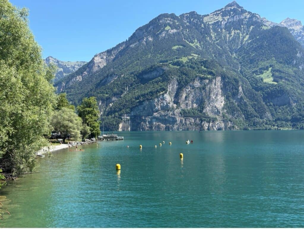
If you’re feeling hungry or thirsty, there’s an excellent stop right by the beach: the Beach House Restaurant and Beach Bar, serving local dishes alongside refreshing drinks with a view.
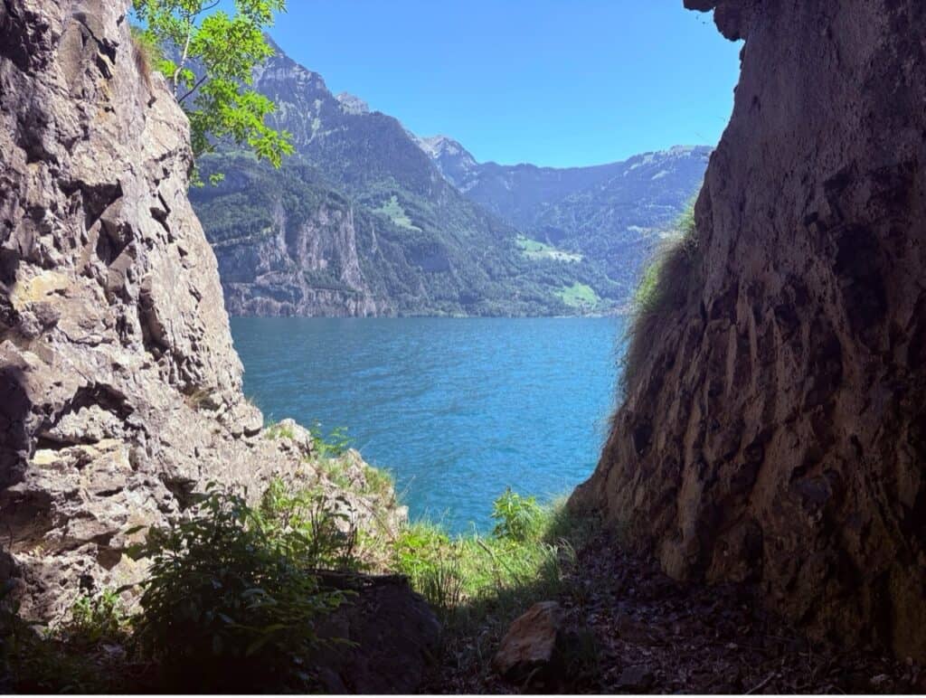
Through Tunnels and History to Bauen
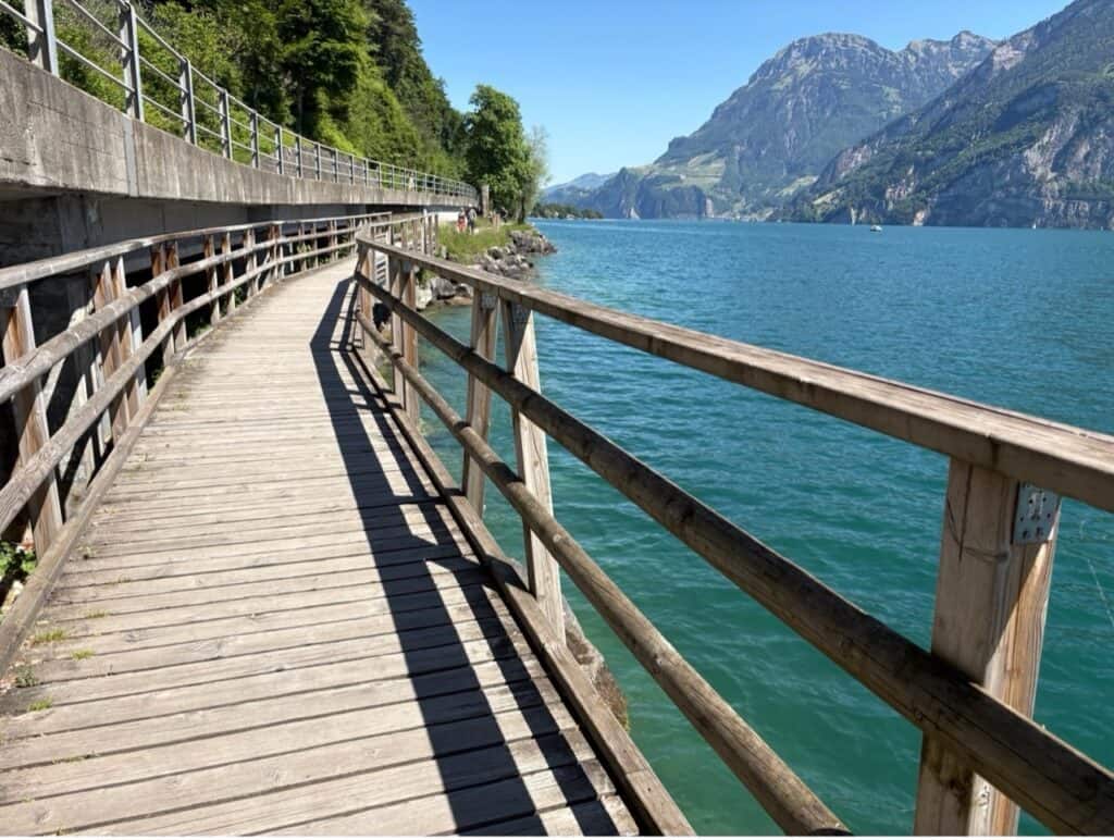
The final stretch from Isleten to Bauen takes roughly 30 to 40 minutes and turned out to be one of my favorite parts of the entire hike.
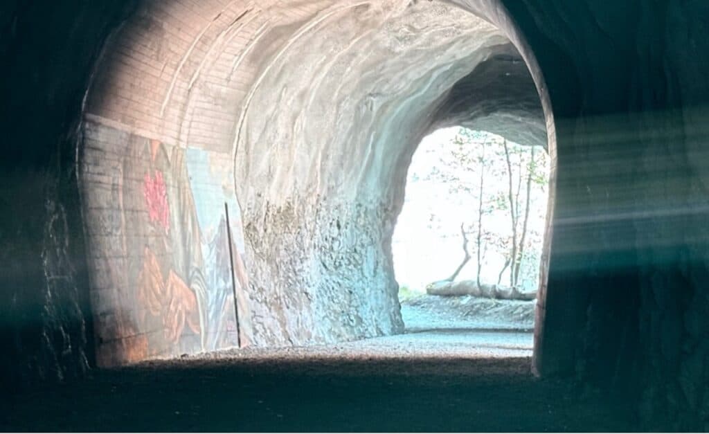
The route becomes wonderfully varied, with tunnels and galleries carved into the rock face, bridges hugging the shoreline, and dramatic views over the lake appearing around every corner.
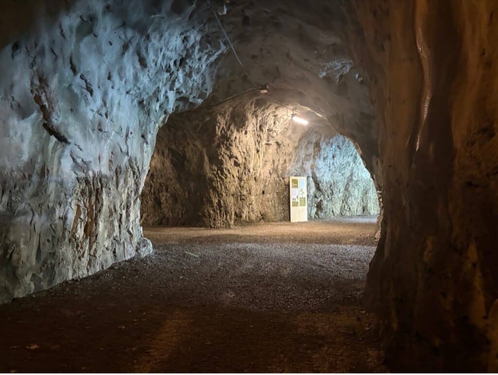
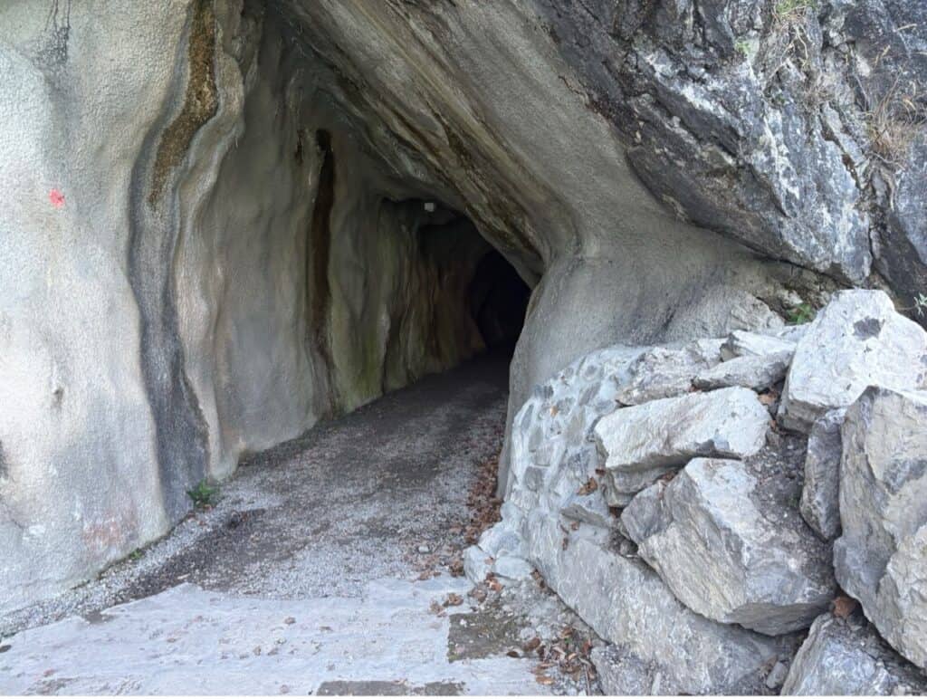
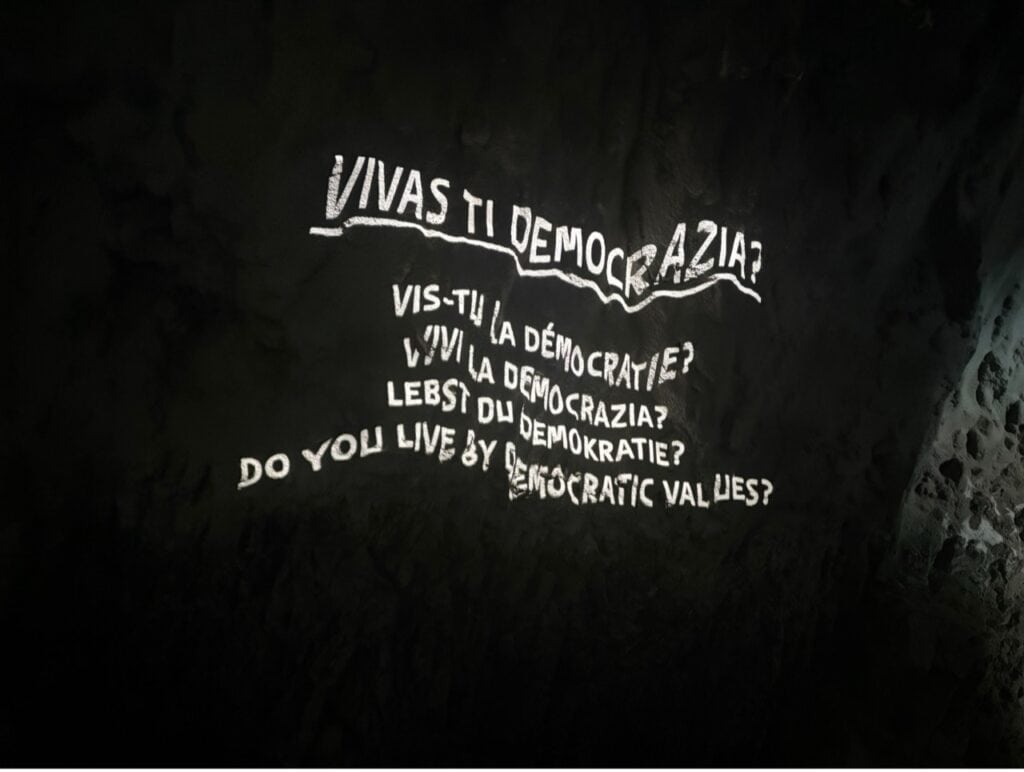
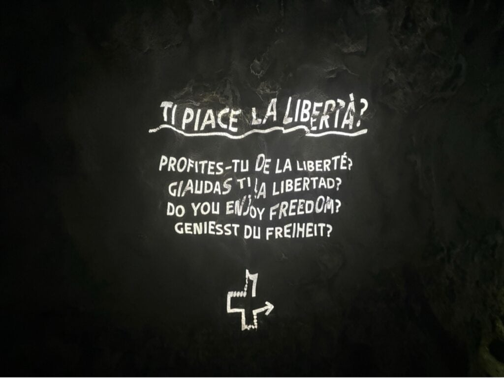
The absolute highlight for me was the Harderband Tunnel.
This is far more than just a tunnel. Light installations, artwork and thought-provoking messages transform the passage into an experience in itself. History, culture and reflection accompany you through the mountain.
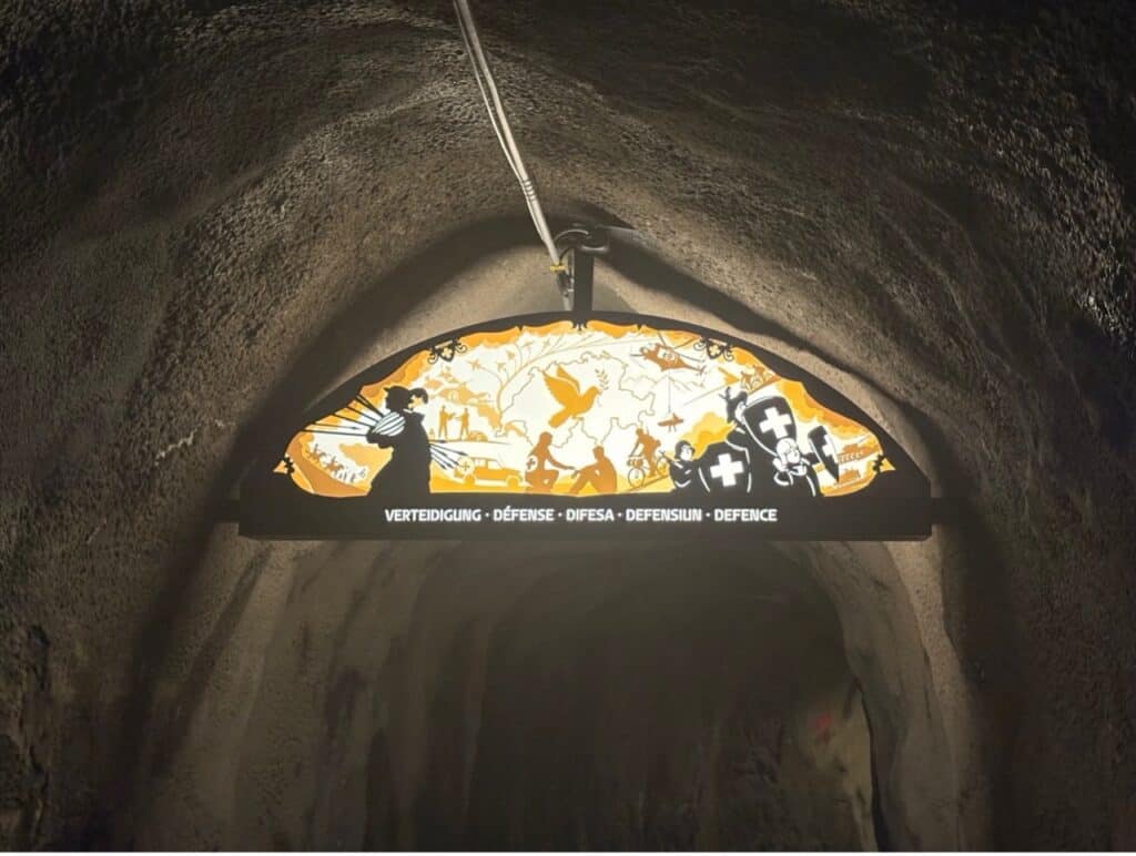
Particularly striking are the illuminated questions displayed along the tunnel walls. One asks: “Do you live democracy?” Others address themes such as solidarity and freedom. They are designed to encourage hikers to pause and reflect on values that continue to shape Switzerland today.
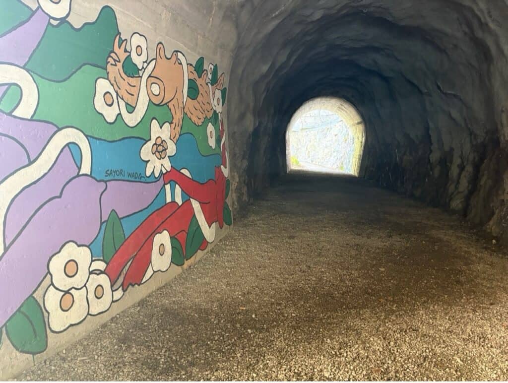
Another fascinating feature is the street art displayed on five tunnel walls under the theme “The Cradle of Switzerland”.
One artwork by Swiss street artist Linus von Moos depicts hands holding four Alpine roses. According to the artist, the four blossoms symbolise Switzerland’s four national languages. The piece also pays tribute to the famous song “Alperose” by Polo Hofer.
For readers unfamiliar with him: Polo Hofer (1945–2017) is often referred to as the father of Swiss rock music. Singing primarily in Bernese dialect, he became one of Switzerland’s most beloved musicians, and “Alperose” remains one of the country’s most iconic songs.
Exploring Historic Bauen
Eventually I arrived in the tiny village of Bauen, beautifully nestled between mountains and lake.
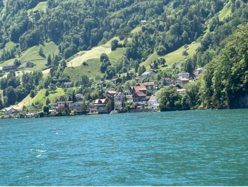
At first glance it seems like a sleepy lakeside village, but it actually holds an important place in Swiss history.
Bauen is the birthplace of Albert Zwyssig, who was born here in 1808. In 1841 he composed the melody that later became the Swiss national anthem. His birthplace, the Zwyssig House, still stands today and now operates as a charming inn.
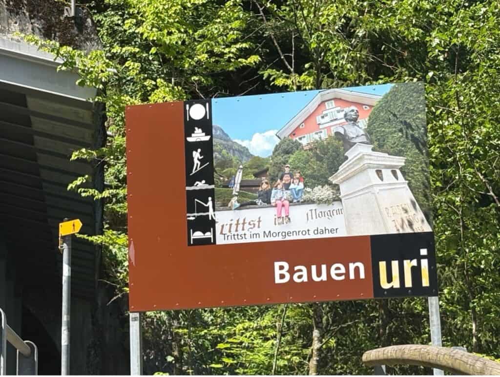
The village itself is small enough to explore on a leisurely stroll, and its peaceful atmosphere makes it a lovely place to end the hike.
Before catching my boat, I wandered down to the dock, where a small kiosk serves fish & chips, as well as cold drinks — a simple but perfect reward after a day spent walking along the lake.
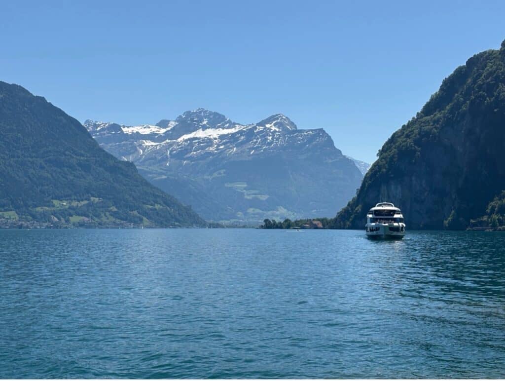
A Relaxing Boat Ride on my Way back to Zurich
From Bauen, I took the boat across Lake Lucerne to Brunnen before continuing by train back to Zurich.
If you prefer, you can also take a boat back to Flüelen and connect to the train network from there.
Either way, it’s a wonderfully scenic journey and a fitting finale to a day that combines nature, history, culture and plenty of opportunities for a refreshing swim.
Some hikes leave you with memories of dramatic summits. Others stay with you because of the countless little moments along the way — ducklings in the reeds, unexpected swims, hidden artwork in tunnels, and coffee breaks overlooking the lake.
This walk from Flüelen to Bauen definitely belongs to the latter category, and that’s exactly why I enjoyed it so much.
Travel Information
Getting from Zurich to Flüelen
Take the train from Zurich to Flüelen. Depending on the connection, there are direct trains (IR 45 direction Locarno) or connections with a change in either Zug or Arth-Goldau. The train ride takes about an hour and 15 minutes.
Getting from Bauen back to Zurich
From Bauen, take the boat to either Brunnen or Flüelen and continue by train to Zurich. Total travel time is usually around 1 hour 45 minutes to 2 hours, depending on connections.
More Adventures Nearby
If you’re inspired to keep exploring the region, there’s plenty more to discover in Central Switzerland, such as the Panorama Hike on Mount Rigi or Golzernsee, a hidden mountain lake in the Maderaner Valley. Both hikes are quite different, but they definitely share that same “why didn’t I come here sooner?” feeling.